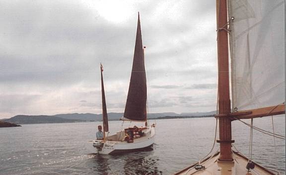
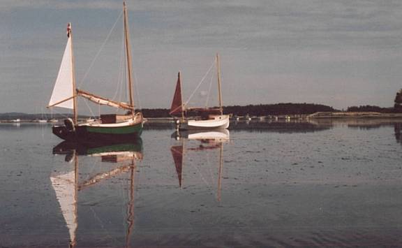
News, questions, and boats for sale.
News:
| There will be a calendar! As soon as I secure a printer (person, not machine) to print small volumes of wall calendars, I will be printing up about 100 Chebacco calendars, for sale here, or maybe at Duckworks. The pictures will mainly be from this webzine. If your boat appears in the calendar, you get one free! I think I have enough photos for the 2004 edition, but if you have good photos of your boat you want considered, send them in! The higher the resolution, the better. |
Questions:
Chebacco’s for sale:
***
The Broughton Archipelago – Jamie Orr
With Wayward Lass in 2003
Sunday: We launched on July 27 from Telegraph Cove, a few miles south of Port McNeil, not far very from the northern end of Vancouver Island. This is just about at the top end of Johnstone Strait, just where it meets Queen Charlotte Straits. Telegraph Cove is on Johnstone Strait, but a mile out and through some small islands, you’re in Queen Charlotte Strait.
The tide was low, but we launched without problems,
and we cast off at 9:10 am, getting the sails up as soon as we were clear of the cove. The sky was overcast, with a forecast for winds of 25 knots from the northwest in the afternoon – there was a small craft warning for later in the day.
The sun came out about mid-morning, and stayed out for the rest of the day. We had light to moderate northwest winds to start with, and were reaching at four and a half knots (by GPS) towards Retreat Passage to the northeast. We mostly used the GPS to tell us what the tidal current was doing to us, but I entered a waypoint to keep us clear of some rocks outside the entrance to Retreat. Around eleven we lost our wind, and after 45 minutes drifting southeast with the flood, we motored until one o’ clock when the wind came back from the west. We sailed and drifted up the passage and through the Fox Islands as the wind went up and down for about an hour and a half, then it steadied and we had a good run. By 3:15 we could see our day’s destination, Echo Bay (or at least the point that hid it.)
We docked at Echo Bay Resort, and bought a gallon of gas there. The folks there didn’t seem very friendly, despite a favourable write up in the guide. Maybe we didn’t spend enough – however, we had choices. At the end of the bay there is a small marine park, with a decent dock and toilets up in the woods – of course, there was also a notice that a cougar had been seen on the 23rd (four days before) and walking alone at night was not recommended! Our other choice was rustic Windsong Village Resort, which offered showers and inexpensive mooring – we eventually pulled in there, the showers being the clincher. The showers were free after a chat about boats and building Wayward Lass. I think the lovely young woman in charge was a fellow dreamer! We fired up the stove and celebrated our first day away with a fine spaghetti dinner, accompanied by a good red wine.

Wayward Lass at the Parks dock in Echo Bay. Echo Bay Resort is in the left, Windsong Village Resort is in the right of the picture.
Monday: The sky was grey, the clouds reaching down to within a hundred feet of the water. No wind, so after a quick cup of tea and a granola bar we fired up Honda and left Echo Bay at 6:25. We didn’t stop for more breakfast because the ebb was only good for another hour or three, and fighting the flood would cut our speed in half. We wanted to reach the west end of Broughton Island, about 20 miles away, that night, with enough time to sight-see on the way. I made a note of the compass course to the entrance to Fife Sound since it looked a bit foggy outside, but we found it easily. Once inside the sound, we followed Indian Passage, inside the Benjamin Islands, along the south side, enjoying the shoreline view (rocks and trees!) We still had the ebb tide under us, as shown by a GPS reading of over six knots with the motor only at half throttle.
Once we left Indian Passage behind, we soon reached the end of the sound, with open water to port and the mass of Broughton Island to starboard. Since the flood tide would not slow us so much in the more open water of Queen Charlotte Strait, we took the time to look into nearby Cullen harbour on Broughton Island. Cullen Harbour is a natural harbour, with no development or people. Booker Lagoon, large and irregular, is reached through a very narrow entrance at the top of the harbour — the entrance is hard to see, as it takes a sharp turn to port right at the end of the harbour, and is less than 40 feet wide. I believe there are some fish farms tucked into the arms of the lagoon, but we didn’t go in far enough to see them. We just looked in and out again, which was good, because the incoming current was noticeably stronger on the way out – the tide had turned to flood, and it wouldn’t have been long before we’d have been stuck there until it turned back again.
Back in Cullen Harbour proper, we anchored for breakfast — only one other boat was anchored there, so we had a good choice of places. This was a porridge morning, so the cooking didn’t take long, and the dishes were soon rinsed and the thermos filled with fresh tea. We started to leave the harbour by a narrow route that exits half a mile west of our original entrance – but we didn’t get out. About half way through, the fog closed down until we couldn’t see more than a 100 yards with any certainty. Tree covered islands that were only 200 yards away were completely invisible. So we made a quick turn back to the harbour, and dropped anchor again. While we waited, we watched an older power cruiser, perhaps a converted fishing boat, come in and head straight for the entrance to Booker. No hesitation, just charged right in, gave a burst on the engine to make the turn, and that was that – some real local knowledge there! They also had their radar antenna turning, not a bad thing on such a day.
After a couple of hours, the fog was definitely lifting, and we took a second try at leaving, this time finding all the islands where they were supposed to be! A light westerly was blowing, so we got the sails up as soon as we were clear and started tacking to the west. And that was pretty well what we did for the rest of the day. Our destination was dead to windward, which was okay when the wind was blowing well, but about half the time it was very light and fluky. As we neared our goal, it steadied again and blew 12 to 15 knots, making Wayward Lass fairly fly.
To reach our anchorage on the northeast side of Dickson Island, we had to turn north between some small islets, and negotiate a rocky dogleg channel. After some discussion, we decided we could do it under sail. We scouted the entrances to two passages, and determined which one was the right one – there were a lot of very similar rocks and islets to confuse the issue. However, once we’d sailed past both entrances, we had no trouble identifying the one we wanted. We turned and ran down the passage, zigged, zagged, and there we were, at the entrance to our bay! However, we were now in the lee of the island and sheltered from the wind, so it took another ten minutes to tack up to the head of the bay. We celebrated by heating up a good stew, also brought from home, for dinner. With more wine, of course.
Tuesday: By 6:45, the water level was down about 12 feet, and our stern was only just afloat. We were taking Carter Passage today, and wanted to enter at slack tide, so again we postponed breakfast and had the anchor up early. It was very foggy, but we could follow the shore of Dickson until the other side of the channel (the one we came through the day before) was visible. We left the inflatable deflating on the cabin roof while we motored the short distance to Carter Passage – there was no wind, so sailing the wasn’t an option. In the event, motoring wasn’t an option either! The outgoing current was so strong, at full throttle we couldn’t make headway in the narrow part of the pass. Since the sides were lined with rocks, we didn’t try to turn to get out, but simply reduced throttle, and let Wayward Lass back down the channel, steering by ferrying across the current as needed. It felt odd, but it worked. Once out, we anchored and opened the thermos while we waited for the current to ease. Half an hour later the things looked better, and sure enough, Honda pushed us through with no further problem.
We needn’t have hurried. It only took an hour to reach the part of Carter Passage that dries out at low tide. It looked like a five-foot high rock wall, right across the passage – this must be why the guidebooks recommend entering at high water slack instead of low water?
It was obvious this was going to be a long wait, so we cooked and ate some pancakes, then I took the inflatable ashore for pictures and scouted the rocks. They extended for some hundred yards, but things weren’t as bad as they first appeared. A slightly more navigable channel ran diagonally across the rocks from the extreme north side at the west end, turning parallel to the shore and exiting the boulder field about three quarters of the way over to the south side. However, even this channel was high and dry for now.
A breeze kept the flies down and kept us from roasting in the sun, and as we watched, water started to flow through from the far side and gradually the level rose. It was a slow business, though, and even when we thought the level was high enough, we had to wait for the current to lessen. Altogether we waited for five hours, but the time passed easily enough. Finally, there was only a small swirl over the biggest rock, and we pulled up the anchor. Using the shore marks I’d noted earlier, I followed what I hoped was a clear route while Dad stood watch at the bow, and in half a minute we were through!
As soon as we were sure the current wouldn’t pull us back, we stopped to raise the sails, and sailed through the rest of the passage. We had a nice little wind behind us, that lasted until we reached Greenway Sound. There’s a sizeable resort there (called Greenway Sound Resort, appropriately enough), and since it was late in the day, we tied up for the night. We didn’t make use of the restaurant, although we were tempted, but we did buy a couple of huge ice cream cones. Our neighbor at the dock was from Portland, Oregon, and we swapped names, looking for common acquaintances. There was a bit of confusion over one of these, and for a minute I thought he said Larry Barker had died! If you’re reading this Larry, you’ll be really glad to know that it was a mistake!
Wednesday: The morning was overcast and cloudy (do we detect a pattern here?) as we cast off, just after 7:00. There was a gale warning posted for the area, but we only had a light west wind that carried us a mile or two down the sound before dying away to nothing. We drifted while we cooked up some porridge for breakfast, then motored, leaving the sails up, to Sutlej Channel, entering that about eight-thirty. The wind came back then, this time from the south, but we motor-sailed as we hoped to get through narrow Penphrase Passage before the tide turned. However, we reached Penphrase at 9:30, and found both wind and tide dead against us, so we dropped the sails and let Honda do all the work. We arrived at Echo Bay again just before 11:00, this time buying a whole gallon and a half of gas. Boating doesn’t have to be costly!
Fifteen minutes later, we were under sail, on our way Tribune Channel.
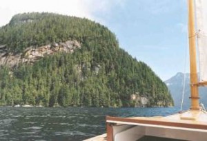
Tribune Channel – not many anchorages along here, the bottom drops off under water just as the land does above!
Part of the channel was beyond the limits of our chart, but from the guidebooks we could see that it was wide and straightforward, with no chance of our going astray. By 1:00 pm we were turning the corner at the most northern part of the channel – we lost the wind briefly, then it turned the corner too, and we had it at our backs once again. This was the pattern whenever we changed direction, the hills funnelled the wind along the channel. Our speeds were in the 5 to 6 knot range, and we sailed passed Watson Cove, where we had thought we might anchor for the night, at 1:30. The sun came out about the same time, so there was no question of stopping.
At 3:40 we reached Trafford Point, the most easterly point of Gilford Island. Our course was now west of south, and we lost our following wind. Instead of bending around the north side of the island, the west wind was now coming up from the south side, against us. We started tacking down the wide channel, but decided that we weren’t making enough progress. We wanted to stop at a small resort on Minstrel Island, several miles onward, but I think now that we let ourselves get too focussed on that – we could have had more sailing and saved ourselves some wet motoring if we hadn’t. But as it was, we furled the sails and started motoring into the wind. Viscount Island, near the southern end of Tribune, forms Sargeaunt Passage on the east side of the channel. We turned down here to have a look. Half way along we passed some narrows, with a nice little anchorage behind them – we could have spent a quiet night here, but didn’t stop.
Coming out of Sargeaunt Passage into Knight Inlet, we found a good 25 knots of wind blowing up the inlet towards us (I see the log calls it a “bitch of a wind” – must be a technical description). Minstrel Island was about three miles away, dead to windward, on the other side of about a million white-topped waves. At first we were able to follow the north shore, but soon had to leave even that minimal shelter to cross the inlet. We tried throttling back to reduce the pounding, but our progress dropped to almost nothing, so we had to turn up the power again. We were wearing our waterproof, insulated cruiser suits, but spray coming over the bows regularly hit our faces and dribbled down our necks – and I’d neglected to change into boots, so my shoes were absolutely soaked. It took an hour and a half to cover those three miles, then another thirty minutes before we were tied up at Minstrel Island Resort. Feeling we owed ourselves a break, we slung our damp suits over the boom, and headed for the dining room for the only restaurant meal of the trip. (The cook was a Mayan Indian from Mexico, and the main course was a great chili, which we washed down with India pale ale, in the interests of multiculturalism.)
Thursday: This morning caused serious doubts about the weather. This was the wettest dawn yet, with a light but steady rain falling from heavy clouds. Although there was nothing stirring yet, strong winds were again forecast from the northwest, and just to round things off, the tide would be against us most of the day. As a precaution, we decided against taking Johnstone Strait, choosing the more sheltered Clio Channel, north of West Cracroft Island. We cast off at 8:15 and motored out through the Blow Hole, (a short, narrow passage named for its habit of magnifying any westerly winds blowing through it) into Clio Channel.
We then drove into Port McNeil to take care of some business, returning to Telegraph Cove two hours later.We made good time motoring down Clio, since the tide hadn’t yet turned against us, but when we reached the next passage, Baronet, we found a strong current running against us. We thought the current might be less in wider Beware Passage, one island to the north, so we turned and wove our way through a flock of rocks and islets. From Beware we passed into Indian Channel, (this is not the Indian Passage mentioned earlier) where we once again found ourselves under a blue sky! We stripped off the cruiser suits and enjoyed the sun through Blackfish Sound and all the way back to Telegraph Cove, arriving about a 1:15.
Back on board, we motored over to the gas dock to fill up. There was only one spot available to tie up, tucked inside a corner. I was daydreaming a bit, I guess, because I suddenly realized we were almost in the corner, and moving much faster than I liked (I prefer to put the motor in neutral and coast in, steering the last few yards with the rudder.) However, I was sitting on the port quarter, with one hand on the boat’s tiller and the other on the motor’s, so I was able to turn the motor, slip it into reverse, and give it throttle. The boat responded perfectly, and we finished stopped dead in the water, right next to the dock. I nonchalantly shut off the motor, stood up to take the stern line ashore, and promptly tripped over the coaming.
No, I didn’t quite go in the drink – my head and shoulders were on the dock, and my shins were resting (grinding, really) on the cockpit coaming. I pulled my two ends together, climbed onto the dock and limped over to the pump.
Once filled up, we headed out and turned west for Alert Bay, a sizeable community on Cormorant Island, arriving at the government dock there at 5:30. (The strong winds predicted earlier never did materialise.) We shared the docks with commercial fishermen, yachts and powerboats, not to mention the 110 foot topsail schooner Pacific Swift, carrying a cargo of teenagers on a “sail and life” training voyage. They were well equipped with water guns, and were giving them a good workout! We fell asleep that night to an evening singalong aboard the Swift.
Friday: The flood tide wasn’t due until noon, so we weren’t in a hurry to get away. We took a walk through “downtown” Alert Bay, then Dad went back to Wayward Lass while I visited the First Nation Heritage Centre. I spoke to a young carver working outside the door – he was working on a new totem pole and instructing an even younger carver in the art. I walked up the hill to see the Big House, where the local Indians hold all their community events. On the way back to the boat, I saw a good juxtaposition of old and new – a diesel powered aluminum launch towing a traditional dugout canoe. Unfortunately I had to switch lenses, and didn’t get a good picture.
After a last cup of coffee at Bill’s Café and Pool Hall (also does take-out pizza) we were on our way back southeast, past Telegraph Cove, bound for Robson Bight. Robson Bight is famous for the number of killer whales, or orcas, it attracts. They come in to rub against the gravel bars there, maybe to scrape off parasites, I’m not sure. A reserve has been established and recreational boaters are not allowed within the boundaries, although the fishermen still fish within them.
The bight is well inside Johnstone Strait, which has a well deserved reputation for rough water, so we paid close attention to the weather forecast. Sure enough, winds up to 20 knots were called for by evening, but based on our experience so far we discounted that a bit. We also noted that Boat Bay is located right across the Strait from the bight, and looked like it would give some protection from northwesters, so we weren’t too worried. However, since we didn’t know for sure, I pulled our 25 pound fisherman anchor from under the floorboards and assembled it. Once together, it took up a significant chunk of the cockpit!
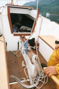
The big guy.
I figure this will hold us in pretty nearly anything!
Taken apart, it fits nicely under the floorboards.
There is an official presence at Robson Bight. Parks workers and volunteers patrol to ensure that boaters don’t harass the whales – fishing boats don’t seem to bother them, partly because their engines and propellers turn at slower speeds than most recreational boats, and partly because the fishermen aren’t following the whales, but going about their own business. (Killer whales are able to avoid the nearly invisible nets because of their very sensitive sonar.) We were visited by two patrollers, both friendly and helpful, and the second one rafted up and chatted for awhile about the whales and his work. Doug was working for a private company contracted to the Parks Branch, and his job involved research as well as policing people like ourselves. He told us they had a camp established on the point beside Boat Bay, so we invited him to stop by the anchorage for a beer later.Since there was no wind again, we were motoring, probably a good thing because the Strait was choked with gillnetters. These boats set nets of 2 or 300 hundred yards in length, generally across the direction of the strait, and from the low cockpit of a Chebacco, it’s hard to tell which net is which. After some practice, we got better at picking out the orange buoys at the ends and figuring out which way each net ran – port or starboard across our path. While doing this, we were passed by the Gikumi, a big, comfortable whalewatching boat built almost 50 years ago for towing log booms. We thought he would find the best path around the gillnetters, so we followed him – this almost paid off in spades, when we realized he wasn’t only avoiding the gillnets, but was heading for a pod of whales in Blackney Passage, at the mouth of (appropriately named) Blackfish Sound. Soon after there were three whale watching boats following the whales, while Wayward Lass was following the whole circus – I could see the odd fin through the binoculars, but that was all. Unfortunately, these orcas were travelling about 5 knots, same as Wayward Lass, so we never caught up with them. Everyone finished up by the north end of the reserve around Robson Bight, but before we got there the whales had disappeared and two of the whalewatching boats had also left. We drifted around not far from the Gikumi, but didn’t see any more whale action.
After that, we restarted Honda and crossed the two miles or so to Boat Bay. We cut through a gap in the kelp beds to save going around Bush Islets, and anchored as close in to the shore as we could. There were already a number of commercial fishing boats anchored between the biggest island and the shore, but farther out, where the water was deeper. Doug came by in his inflatable a few minutes later and rafted up again. We’d scarcely opened our beers when there was a huffing noise, and an orca appeared just outside the kelp! We sat there in our front row seats while a pod of some 25 whales swam past.
Doug put his hydrophone over the side and we listened to the whales through the speaker. He was instantly able to identify the pod as “A” Clan – each pod has its own distinct dialect. “A” Clan is a resident pod, with a home range, although they do move around quite a bit. Apparently these whales choose mates who do not speak the same dialect, thus ensuring that the gene pool gets stirred. He also told us that transient whales are generally silent, because they feed on marine mammals (seals, porpoises) and calling would give away their position. The resident whales feed on fish, and are quite vocal.
Enough natural history – besides, that’s about all I know.
We also talked about the weather, and the overly pessimistic forecasts. Doug told us this is not uncommon in the area. There are separate forecasts for each of Johnstone and Queen Charlotte straits, but these are long straits, and the forecasts cover large areas. Where we were, relatively near the ends of both, the wind is generally less than predicted, as long as it’s a northwest wind. He warned us that when the forecast is for strong southeast winds, we’d get them full strength, and had better find shelter as soon as we could!
We had a quiet night. All the fishing boats had bright anchor lights, and this made quite a scene once it got dark. We tried to take a picture of this floating “village”, but the results didn’t do it justice. We used the 25 pound anchor, since it was all ready, even though it was overkill. This is the first time it’s been wetted, and we found it wasn’t too hard to handle, at least we didn’t knock any paint off Wayward Lass.
Saturday: I woke up before six, and looked out the back of the cockpit cover. Something caught my eye in the kelp, so I took another look through the binocs and there was an empty kayak caught in the strands. Luckily I’d had our little inflatable out to visit the researchers’ camp the night before, and hadn’t deflated it. I jumped in and rowed over to the kayak, which was in perfect order, equipped with tow line, pump and spare paddle, all neatly strapped to the deck. There was no water in it, which made me think it had probably just floated away rather than capsizing – a quick scan didn’t reveal any dead, drowned kayakers, anyway!
I really didn’t want to give that kayak back to anyone, but one of the researchers had mentioned a kayak camp about a mile down the shore, so we thought it likely that someone there had neglected to pull it up above the high tide mark. However, we thought we’d let them worry about it while we had our bacon and eggs. While we were cleaning up after, one of the larger fishing boats pulled up its anchor and moved away, revealing a charter/tour boat behind, with a whole raft of kayaks tied alongside. This seemed an even likelier source of stray kayaks, so once we had our own anchor up, we motored over to see if they had lost any. Sure enough they had, so we turned over my find – Ouch! They were grateful, and asked if they could do anything for us in return, but since we were now homeward bound, we had to decline. We couldn’t even manage another cup of coffee so soon after breakfast.
We motored out through the same gap in the kelp, and started west. We had hardly gone any distance though, when we saw a pair of whales about 300 hundred yards away, just ahead of us and closer in to the shore. Thinking they were coming our way, and remembering the whale watching guidelines, I shut down the motor, but the whales were going west as well so they didn’t get closer. I restarted Honda, and carried on our way, which paralleled the orcas’ course, keeping them on the starboard bow. After a while, they started to pull away from us and I thought they were headed for Blackfish Sound. However, either these two, or a different pair, suddenly appeared closer to us, on a converging course. The guidelines say you should stop your engine and let the whales leave the area, but I felt that in this case, there wasn’t much point. The whales were faster than us, and they were the ones choosing to come closer. We had our own destination, and I thought that if we kept a constant course and speed, they could easily avoid us.
In the event, they pretty well ignored us. Our courses continued to converge, and I took as many pictures as I could. I had to guess where they were likely to rise next, set the focus to what I thought was the right distance, and sit with my eye glued to the viewfinder. A lot of the time I missed the picture by a fraction of a second.
They were coming closer, as I said, but it was still a surprise when the big bull (identifiable by the six-foot fin) surfaced immediately ahead of us, less than a boat length (20 feet) away! I heard him puff, but couldn’t see him properly – I had to settle for a snap shot of his fin sticking up above the cabin hatch. That’s about as close as I ever expect to get to a killer whale in the wild.
The two whales continued on their way, and we continued on ours, now slowly moving apart. I didn’t get any more pictures, but we did get several excellent views of them – once both rose together, we could clearly see the markings on the top half of their bodies – that would have been a prize-winner if I’d got it on film. I couldn’t really complain though, we’d had a fantastic sight of these powerful and intelligent creatures.
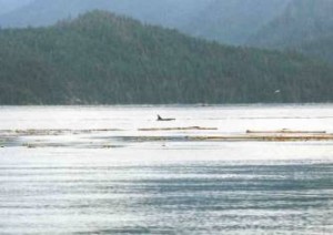
Here’s the best that I did get, using a 200 mm lens.

Closest!
This is the bull, less than twenty feet from Wayward Lass. That’s the hatch cover in the foreground.
That was about it. We dodged a few more gillnets, not so many as the day before, and we tried to sail, but the wind just wasn’t there and we took the sails down again after only a few minutes. We pulled in to Telegraph Cove well before lunch time – and not long after low tide. We had some fun recovering Wayward Lass because of that low tide. The end of the ramp drops off abruptly, and we couldn’t get the trailer in very far – the bunk for the keel was left 2 or 3 inches above the surface. We lined up the sloping forward part of the keel with the “U” of the centre bunk, and Dad held Wayward Lass there with the outboard while I hooked up the winch and started cranking. Once the keel couldn’t float out of the “U”, Dad shut off the motor and moved to the bow, to lighten the stern, then I proceeded to pull Wayward Lass right out of the water and up onto the trailer with the winch. However, I don’t recommend this, since I found after that I’d bent the steel frame of the winch, and may have to replace it.Then we drove home. It was a great trip (is there any other kind?) and I think we’re getting better at this. I’ll mention some of the things that made a difference – probably pretty obvious things, but it’s taken me this long to figure them out, so I’ll do it anyway.
We’re slowly improving our standard of living – we ate well, despite having only one meal ashore. I planned the menu carefully, and didn’t resort to canned stew – although we did take along home-made spaghetti sauce and stew. We carried a soft-sided cooler this time, freezing our spaghetti sauce, stew, juice and milk before leaving home. They didn’t stay frozen for very long, but everything stayed cool, at least. The milk lasted three days like this.
A thermos is an essential part of our cruising gear. We had the stove going every morning and night, and we refilled the thermos each time. This gave us hot drinks first thing in the morning and throughout the day – we find these take the sting out of cold wind and rain. We also made a habit of having a glass of wine before dinner – this made a nice finish to the day’s efforts. A two litre sack of Australian red lasted us the whole trip, and the sack was far more practical than bottles as it kept perfectly..
Once again we used the tarp over the boom – this did the job, but we had to hunch over in the cockpit. A Mark II tent was in build, but didn’t get done in time. This has since been finished and tested, and has greatly improved our accommodations, letting us sit erect like human beings!
That’s it for now. So long and good sailing!
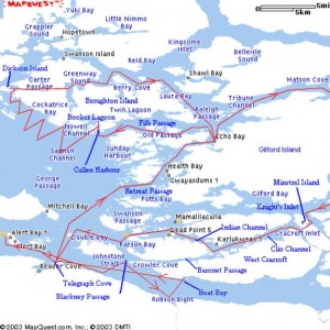
Where we went…
By coincidence, Mapquest cuts off the same piece of the chart that we were missing. To show it here, I would have to make the chart too small, or lose some of the west side. So I figured if we managed without the eastern part of Tribune, so could you!
***
Mystery Cat-Yaw – a conversation
David Huckabee (dhuckabee@crs.loc.gov) has sent you the following article from the Camden, Maine VillageSoup.
I wonder, is this “abandoned daysailer” in Rockland, Maine a modified Chebacco?
THE MYSTERY OF THE DESERTED DAYSAILER – (09/09/03)
To read the complete article, click on the link below.
http://rockland.villagesoup.com/Community/Story.cfm?StoryID=17229
—————————–
Camden, Maine VillageSoup – All Things Community
http://camden.VillageSoup.com
thecrew@VillageSoup.com
—————————————————————————————-
Sure looks like one. I’d bet it’s Samantha.
—————————————————————————————-
I don’t see Samantha on the registry. Has she been stolen?
—————————————————————————————-
It’s on the for sale page.
—————————————————————————————-
I just called his number and asked him if his boat was stolen. When he
said no, I started to tell him that it might be in Portland, and we were
disconnected before I could complete my sentence.
—————————————————————————————-
Richard,
I talked with the Portland Maine harbor master this morning. The
Rockland police have identified the owner as Paul Thober. The harbor
master confirmed that the boat is Samantha. He has tried to reach Paul
at the number in your the advertisement, but thus far Paul has not
responded.
—————————————————————————————–
Any updates?
—————————————————————————————–
Richard,
Not yet. I’m in Washington, DC, where we are consumed with
Hurricane interest right now. I plan to give the harbor master a call
when we get over the hysteria to see what is going on in Rockland ME.
David
——————————————————————————————
David Huckabee (dhuckabee@crs.loc.gov) has sent you the following article from the Camden, Maine VillageSoup.
Update on Samantha.
TIPS ABOUND, BUT VESSEL’S IDENTITY STILL A MYSTERY – (09/15/03)
To read the complete article, click on the link below.
http://rockland.villagesoup.com/Community/Story.cfm?StoryID=17356
—————————–
Camden, Maine VillageSoup – All Things Community
http://camden.VillageSoup.com
thecrew@VillageSoup.com
———————————————————————————————
Richard,
See the attached message from the editor of the community
newsletter regarding the status of Samantha.
David
++++++++++++++++++++++++++++++++++++++++++++++++++++++++++++
Hi David,
Thanks for the information. I’ve passed it along to the local police
and harbormaster to help with their investigation.
If you happen to contact Mr. Thober again, have him get in touch with
Rockland PD (594-0316) or the Harbormaster (594-0312) quickly. Soon, the
boat will be sent to the city’s impound lot, where it will sit.
Don’t hesitate to contact me as well, if anything else comes up. And
thanks again.
Tony Ronzio
Anthony J. Ronzio
Rockland Bureau Chief
VillageSoup.com/VillageSoup Times
207.594.5351 ext. 330 (office)
207.594-5481 (fax)
201.691.0643 (mobile)
aronzio@villagesoup.com
—–Original Message—–
From: David Huckabee [mailto:DHUCKABEE@crs.loc.gov]
Sent: Tuesday, September 16, 2003 9:59 AM
To: Anthony Ronzio
Subject: Mystery Cat-Yawl
Deary Anthony,
I too believe the mystery boat to be a modified Phil Bolger
designed cat-yawl, Samantha, owned by Paul Thober. After reading your
story last week, I forwarded a copy of your article to the editor of the
on-line Chebacco newsletter (Richard Spelling) in Canada. (See
https://www.chebacco.com )
He replied that the boat looked like the Samantha which had been
listed for sale on his web site. (see text below) In the middle of last
week I called Paul Thober at the number listed in his advertisement and
asked him whether his boat had been stolen. He replied “No.” I then
told him that a modified Chebacco 20 had been found abandoned in
Rockland. Before I could finish saying “Rockland,” our connection was
lost. I don’t know whether he hung up, or we lost a signal.
After talking with the Harbor Master, who had obtained Mr. Thober’s
number from other sources, I was told that his office had not been
successful in reaching Mr. Thober.
The connection between the boat and Mr. Thober could be more easily
made once the boat is pulled from the water. Most Chebacco 20’s have
been built with a shorter cabin, and more importantly, a combination
keel-centerboard. According to Mr. Thober’s advertisement, this boat
was built with only a keel. Very few Chebacco’s have been built in this
way.
David Huckabee
++++++++++++++++++++++++++++++++++++++++++++++++++++++++
—————————————————————————————-
Richard,
I was in Rockland, ME the week of Oct. 13-18. I stopped in at the
Rockland harbormaster office and inquired about the boat. It was still
on a mooring, but was scheduled to be pulled on the 18th. Rockland now
has decided that the city owns the boat. In six months they will
auction it off.
The Rockland city attorney was in Portland, ME on other business,
and stopped in at the previous owner’s last address. He had moved,
leaving no forwarding address. Also, the phone number listed in his
advertisement on your web site has been assigned to another person.
The mystery continues. Since the boat was stripped of all
equipment, sails, etc., maybe the previous owner is intending to build
another boat.
David Huckabee
———————————————————————————–
***
Mary-Beth, Too – Dave Neder
Good Evening:
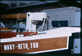
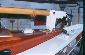
The mast base detail shows the cable and antenna lead exists. My VHF antenna is mounted on the mast head. The anchor light is also mounted on the mast head. I also have a “machinery light” on the forward part of the mast approximately 18” above the highest location of the gaff jaws.
The tiller head is made of oak and self tapping screwed to the tiller post.
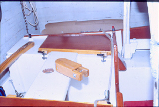
The ventilator is photo cell charged.
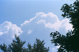
The sky was just too beautiful a picture to pass up.
Regards
Dave Neder
***
Stealing Horses from the Barn and Back Again
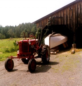
After a year upside down in the barn while we were overseas, Stealing Horses was ready to be flipped. We slipped birch logs under the strongback, and pulled her out with the tractor. A bit of washing was in order!
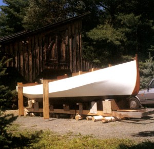
Then, a few days later, a bunch of people came over early one morning for the flipping. The sheep were interested!
We bolted 2x4s across the boat at the transom and various bulkheads and molds, and connected most of these with a longitudinal 2×6 that was some 8” beyond the topside. This was the pivot for turning over on gravel. Then the boat was lowered down on to old tires.
We had set carpeted seats for each of the mold/bulkhead locations and we then walked the boat back on the strongback. With not much effort we then nudged Stealing Horses back in the barn with the tractor, careful to not tip her too much. Will we make progress next season? Hope so!
***
An Interesting Quote – Randy Wheating
Hi Richard
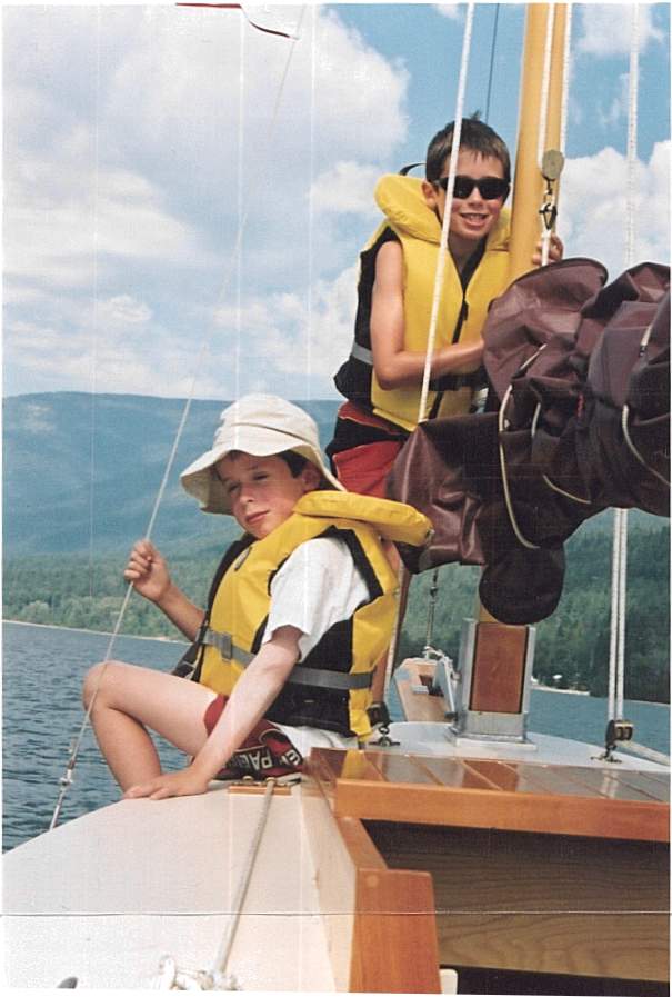
I forgot to add this photo with the earlier one. My two boys, Jacob and Samuel, on Bluster.
Randy Wheating
Hi Richard
I came upon this interesting quote by the American adventure writer Ernest Gann:
“A good boat should drink six, eat four and sleep two.”
I think our Chebaccos fit this description quite nicely.
Cheers,
Randy Wheating
Ps I have attached a photo of our ‘Bluster’ beached on the east shore of Kootenay Lake, located in central British Columbia. This area is known locally as Crystal Beach because it is the site of a turn of an early 1900s smelter and one can search for crystals in old mine debris piles along the shore.
***
KittyHawk under wraps – Donna + Vincenzo
Dear Richard,
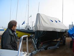
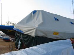
Attached are some photos of our Chebacco, KittyHawk, covered with her tarp and skirts. The tarp is made of heavy PVC and has six vents to allow air circulation (the blue triangles in the photos). It was custom-made to fit snugly over the tabernacle and extends 20 cm over the rail. The most sun-exposed parts of Kitty’s black hull are draped with skirts made of cheap loosely woven plastic fabric. The tarp cost about $230 to make, but was worth it, because it protects the boat from the sun, rain, dust, and ‘peeping toms’.
Buon Vento
Donna D’Agostino
Vincenzo Ciminale
***
Sidney Spit – Randy Wheating
Weekend Chebacco Rendezvous
Wayward Lass and Bluster
Sidney Spit Marine Park, BC
August 23-25, 2003
On August 23, Lisa and I along with our two boys Jacob and Samuel (ages eight and six respectively) of Chebacco Bluster spent a wonderful three day cruise in the company of Chebacco enthusiast Jamie Orr and his wife Maureen aboard Wayward Lass.
We met at the public launch ramp in the town of Sidney, BC, located on the southern end of Vancouver Island. This involved an easy ferry crossing from the mainland for us and short drive for Jamie and Maureen.
This was the first overnight cruise for the Bluster crew so there was a fair bit of good-natured confusion but in due course we launched and were off. Loaded down with camping kit, food, water, etc., Bluster carried it all without trouble.
Wayward Lass and Bluster motored together (no wind) across Sidney Channel then deep into the protected bay of Sidney Spit Marine Park. We rafted up to enjoy a cockpit picnic and a toast to our cruise. After lunch we sailed out of the bay to explore some of the surrounding islands for the afternoon. Later, back in the bay, we unloaded our kit. Lisa and the children slept ashore in the tent. The boat-in-only camping area (once a homestead) is a lovely grassy spot with overgrown hay fields and climbing trees. Our kids immediately met other kids and disappeared for exploration and adventures. Jacob asked why we had never come here before. I slept aboard Bluster, anchored just off the drying shallows. Jamie and Maureen slept aboard Wayward Lass using Jamie’s ingenious boom tent.
The next morning we sailed out of the bay for a six-mile (or so) voyage to Portland Island (Princess Margaret Marine Park). We enjoyed some fair winds and the pleasant company of Jamie and Maureen. It is a novelty for us to be able to sail quietly along with another boat, close enough to converse. This is especially interesting in identical boats. Jamie’s experience and experimentation gave him a slight speed advantage so I made a point of keeping Wayward Lass in our wind shadow. We anchored for lunch at Portland Island then Bluster headed back to Sidney Spit (Jacob and Sam were busting to get back to the campground and there new friends there). Wayward Lass arrived back later in the afternoon. With the kids playing and the wives reading on beach Jamie and I took Bluster out for a short sail before the wind died and we motored back.
The final morning revealed precious little water under our keels (we knew we were pushing our luck anchoring so far into the bay). We quickly broke camp and I borrowed Jamie’s tender ‘Creamsicle’ to ferry our kit out to Bluster, now anchored in deeper water. Lisa and Jacob walked the two miles to the end of the Spit while Sam and I brought Bluster out of the Bay to retrieve them. But as they say, the sea can be unforgiving at times….we promptly ran aground on the mud bottom. Between paddling and hopping out to push Sam and I eventually found a channel and freedom from the bay. Wayward Lass, employing similar style and technique also managed to win the race against the tide. The virtues of a Chebacco’s shallow draft, light displacement and keel-protected motor were very appreciated.
We motor sailed back across Sidney Channel to the ramp where we soon had our boats back on dry land, strapped down and ready to drive back to our respective homes.
Many thanks to Jamie and Maureen for their company, guidance and patience.
A very memorable trip.
Randy Wheating
Port Moody, BC
Canada


